20.2 Urbanization
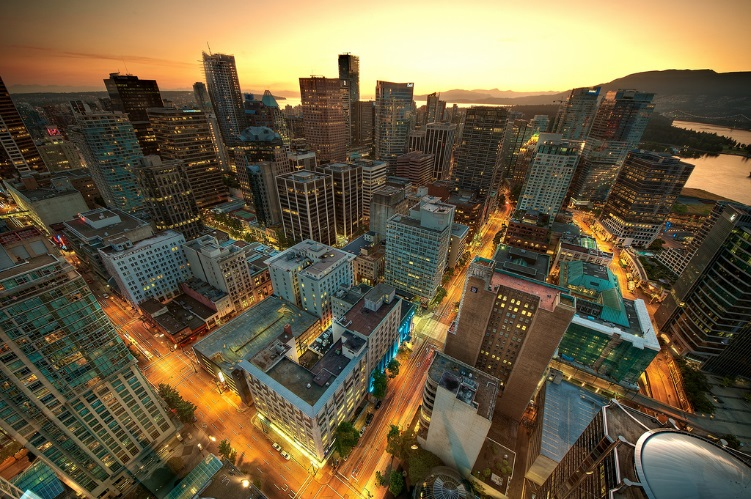
Urbanization is the process of the formation of cities. Someone specializing in urban sociology would study the social, political, and economic relationships that form in and around cities. In some ways, cities can be microcosms of universal human behaviour, while in others they provide a unique environment that yields their own brand of human behaviour. Defining what a city is usually brings to mind a distinction between the rural and the urban and the various associations people attach to the forms of life and people there. However, especially in the 21st century, there is no strict dividing line between rural and urban; rather, there is a continuum where one bleeds into the other. Nevertheless, once a geographically concentrated population has reached approximately 100,000 people, it typically behaves like a city regardless of what its designation might be.
The Growth of Cities
According to sociologist Gideon Sjoberg (1965), there are three prerequisites for the development of a city: First, good environment with fresh water and a favourable climate; second, advanced technology, which will produce a food surplus to support non-farmers; and third, strong social organization to ensure social stability and a stable economy. Most scholars agree that the first cities were developed somewhere in ancient Mesopotamia, though there are disagreements about exactly where. Most early cities were small by today’s standards, and the largest city around 100 CE was most likely Rome, with about 650,000 inhabitants (Chandler and Fox 1974). The factors limiting the size of ancient cities included lack of adequate sewage control, limited food supply, and immigration restrictions. For example, serfs were tied to the land, and transportation was limited and inefficient. Today, the primary influence on cities’ growth is economic forces.
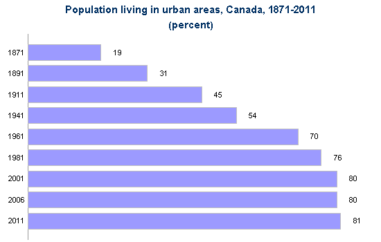
Nearly three-quarters of Canadians (73.7%) lived in one of Canada’s large urban centres with a population of 100,000 or more in 2021, up from 73.2% in 2016 (Statistics Canada, 2022). (Note that Figure 20.15 above refers to the percentage of Canadians living in “population centers” with a population of 1000 or more). These large centres or census metropolitan areas (CMAs) accounted for most of Canada’s population growth between 2016 and 2021. One of the drivers of urbanization is immigration, as more than 90% of immigrants settled in CMAs. There were six more CMAs in 2021 compared with five years earlier including Fredericton, Drummondville, Red Deer, Kamloops, Chilliwack and Nanaimo, another sign of the increasing urbanization in Canada.
Urbanization in Canada
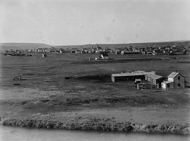
Urbanization in Canada proceeded rapidly during the Industrial Era of 1870 to 1920. This was the origin of the industrial city in Canada, a city in which the major business and employment activities revolve around manufacturing, building, machining. The percentage of Canadians living in cities went from 19% in 1871 to 49% in 1920 (Statistics Canada 2011). As more opportunities for work appeared in factories, workers left farms (and the rural communities that housed them) to move to the cities. Urban development in Canada in this period focused on Montreal and Toronto, which were the two major hubs of transportation, commerce, and industrial production in the country. These cities began to take on a modern industrial urban form with tall office towers downtown and a vast spatial expansion of suburbs surrounding them.
Following the Industrial Era, urbanization in Canada from the 1940s onward took the form of the corporate city. Stelter (1986) describes the corporate city as being more focused economically on corporate management and financial (and other related professional) services than industrial production. Five features define the form of corporate cities: dispersal of population in suburbs, high-rise apartment buildings, isolated industrial parks, downtown cores of office towers, and suburban shopping malls. This development was made possible by the reorientation of the city to automobile and truck use, deindustrialization and the rise of the service and knowledge economy, and a spatial decentralization of the population.
Finally, we might note the transformation of the corporate city into a postmodern city form. Unlike the industrial and corporate city forms that preceded it, the postmodern city is characterized by having no obvious centre. Postmodern cities are decentred, defined by their orientation to circuits of global consumption, the fragmentation of previously homogeneous urban cultures, and the emergence of multiple centres or cores. John Hannigan (1998) describes three related developments that characterize the postmodern city: the edge city, dual city, and fantasy city. Edge cities are urban areas in suburbs or residential areas that have no central core or clear boundaries but form around clusters of shopping malls, entertainment complexes, and office towers at major transportation intersections. Dual cities are cities that are divided into wealthy, high-tech, information-based zones of urban development and poorer, run-down, marginalized zones of urban underdevelopment and informal economic activity. Mike Davis (1990) used the term “fortress city” to describe the way that cities abandon the commitment to creating viable public spaces and universal access to urban resources in favour of the privatization of public spaces, a “militarization” of private and public security services, and the creation of exclusive gated communities for the wealthy and middle classes. Fantasy cities are cities that choose to transform themselves into Disneyland-like “theme parks” or sites of mega-events (like the Olympics or FIFA World Cup competitions) to draw international tourists. Victoria, B.C., for example, has branded itself as a safe, historical — “more English than the English” — heritage destination for cruise ships and other types of tourism.
Suburbs and Exurbs
As cities grew more crowded, and often more impoverished and costly, more people began to migrate back out of them; but instead of returning to rural small towns (like they had resided in before moving to the city), these people needed close access to the cities for their jobs. In the 1920s, when the majority of Canadians began to live in urban centres, suburbs also developed. Suburbs are the communities that surround cities, typically close enough for a daily commute in, but far enough away to allow for more space than city living affords. The pace of surburbanization increased during the postwar period (1940s-1950s) due to over-crowded city centres, the return of WWII veterans, the beginning of the baby boom, lower house prices and property taxes and the desire for spatiousness. Suburban infrastructure including schools and highways were constructed and cars became the means of connecting outlying areas with urban industrial nodes and city centres (Belshaw, 2015).
The bucolic suburban landscape of the mid-20th century has largely disappeared due to sprawl. Urban sprawl is characterized by the uncontrolled growth of urban areas with a low population density, high dependence on automobiles, and poor planning. This type of development extends over vast areas of land, resulting in a significant distance between residential areas, commercial establishments, and workplaces. Such development leads to a significant segregation between residential and commercial land uses and has a negative impact on the inhabitants of these areas as well as the ecosystems and wildlife that have been displaced. It contributes to traffic congestion, which in turn contributes to commuting time. Commuting times and distances have continued to increase as new suburbs developed farther and farther from city centres. Simultaneously, this dynamic contributed to an exponential increase in natural resource use, like petroleum, which sequentially increased pollution in the form of carbon emissions.
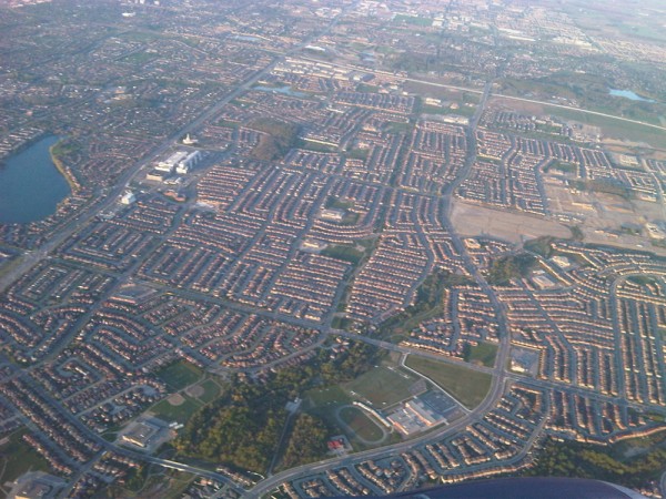
As the suburbs became more crowded and lost their charm, those who could afford it turned to the exurbs, communities that exist outside the ring of suburbs. Exurbs are typically populated by even wealthier families who want more space and have the resources to lengthen their commute. It is interesting to note that unlike U.S. cities, Canadian cities have always retained a fairly large elite residential presence in enclaves around the city centres, a pattern that has been augmented in recent decades by patterns of inner-city resettlement by elites (Caulfield 1994; Keil and Kipfer 2003).
As cities evolve from industrial to postindustrial, this practice of gentrification becomes more common. Gentrification refers to members of the middle and upper classes entering city areas that have been historically less affluent and renovating properties while the poor urban underclass are forced by resulting price pressures to leave those neighbourhoods. This practice is widespread, and the lower class is pushed into increasingly decaying portions of the city.
Currently Canada’s large urban centres are seeing both of these phenomena concurrently (Statistics Canada, 2022). Downtown areas are growing in population and density faster than before due to urban policies promoting densification and the desire to be closer to employment, services and entertainment centres. On the other hand, urban sprawl continues and in Toronto, Montreal and Vancouver is accelerating due to opportunities to work from home and lower housing prices. The population of neighborhoods located between downtown areas and the farthest suburbs is also increasing, but at a considerably slower pace.
Together, the city centres, suburbs, exurbs, and metropolitan areas all combine to form a metropolis. When a group of metropolitan areas merge into a continuous urban area they become a megalopolis, a huge urban corridor encompassing multiple cities and their surrounding suburbs. The term megalopolis is commonly used to describe the Northeastern United States urban corridor, which includes cities such as Boston, New York City, Philadelphia, and Washington D.C. In Canada, the Toronto-Hamilton-Oshawa, Vancouver-Abbotsford-Chilliwack, and Calgary-Edmonton corridors are similar megalopolis formations. These metropolises use vast quantities of natural resources and are a growing part of the North American landscape.
Making Connections: Sociology in the Real World
Suburbs Are Not All White Picket Fences: The Banlieues of Paris
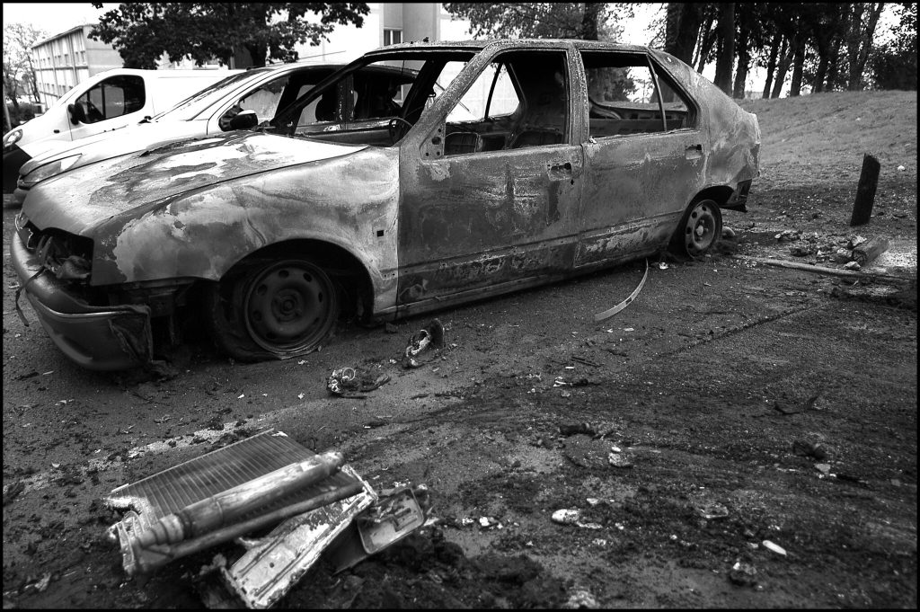
What makes a suburb a suburb? Simply, a suburb is a community surrounding a city. However, when one pictures a suburb, the image may vary widely depending on the society. In Canada, most consider the suburbs home to upper- and middle-class people with private homes. In other countries, like France, the suburbs––or “banlieues”–– are synonymous with housing projects and impoverished communities. In fact, the banlieues of Paris are notorious for their ethnic poverty, violence and crime, with higher unemployment and more residents living in poverty than in the city centre. Further, the banlieues have a much higher immigrant population, which in Paris is mostly Arabic and African immigrants. “The people who live in these communities are two times more likely to be immigrants than the national average and three times more likely to be unemployed” (Lefebvre, 2022). This contradicts the clichéd Canadian image of a typical white-picket-fence suburb.
In 2005, serious riots broke out in the banlieue of Clichy-sous-Bois after two boys were electrocuted while hiding from the police. They were hiding, it is believed, because they were in the wrong place at the wrong time, near the scene of a break-in, and they were afraid the police would not believe their innocence. Only a few days earlier, interior minister Nicolas Sarkozy (who later became president), gave a speech touting new measures against urban violence and referring to the people of the banlieue as “rabble” (BBC 2005). After the deaths and subsequent riots, Sarkozy reiterated his zero tolerance policy toward violence and sent in more police. Ultimately, the violence spread across more than 30 towns and cities in France. Thousands of cars were burned, many hundreds were arrested, and both police and protesters suffered serious injuries.
Then-President Jacques Chirac responded by pledging more money for housing programs, jobs programs, and education programs to help the banlieues solve the underlying problems that led to such disastrous unrest. None of the newly launched programs were effective. President Sarkozy ran on a platform of tough regulations toward young offenders, and in 2007 the country elected him. More riots ensued as a response to his election. In 2010, Sarkozy promised “war without mercy” against the crime in the banlieues (France24 2010). Ten years after the Clichy-sous-Bois riot, with Socialist president, François Hollande, replacing Sarkozy and promising an end to the ghettos, circumstances were no better for those in the banlieues. “Despite years of emergency assistance plans, the banlieues remain in crisis…the prime minister, Manuel Valls, made the most damning indictment yet of the country’s bitter social divide, saying there was ‘territorial, social and ethnic apartheid’ in France” (Chrisafis, 2015).
Lefebvre (2022) notes that although investment has been made in urban renewal and physical infrastructure, provision of basic social services, education, child care and health in the banlieues lags far behind the rest of the country.
Urbanization Around the World
As was the case in North America, other urban centres experienced a growth spurt during the Industrial Era. In 1800, the only city in the world with a population over 1 million was Beijing, but by 1900, there were 16 cities with a population over 1 million (United Nations 2008). The development of factories brought people from rural to urban areas, and new technology increased the efficiency of transportation, food production, and food preservation. For example, from the mid-1670s to the early 1900s, London increased its population from 550,000 to 7 million (Old Bailey Proceedings Online 2011). The growth in global urbanization in the 20th and 21st centuries is following the blueprint of North American cities but is occurring much more quickly and at larger scales, especially in peripheral and semi-peripheral countries. Shanghai almost tripled its population from 7.8 million to 20.2 million between 1990 and 2011, adding the equivalent of the population of New York City in 20 years. It is projected to reach 28.4 million by 2025, third in size behind Tokyo (38.7 million) and New Delhi (32.9 million) (United Nations 2012).
Global urbanization reached the 50% mark in 2008, meaning that more than half of the global population was living in cities compared to only 30% in 1958 (United Nations 2008). Global urbanization has been uneven between core countries and the rest of the world, however. Two developments might serve to illustrate some of the stark differences in the global experience of urbanization: the formation of slum cities and global cities.
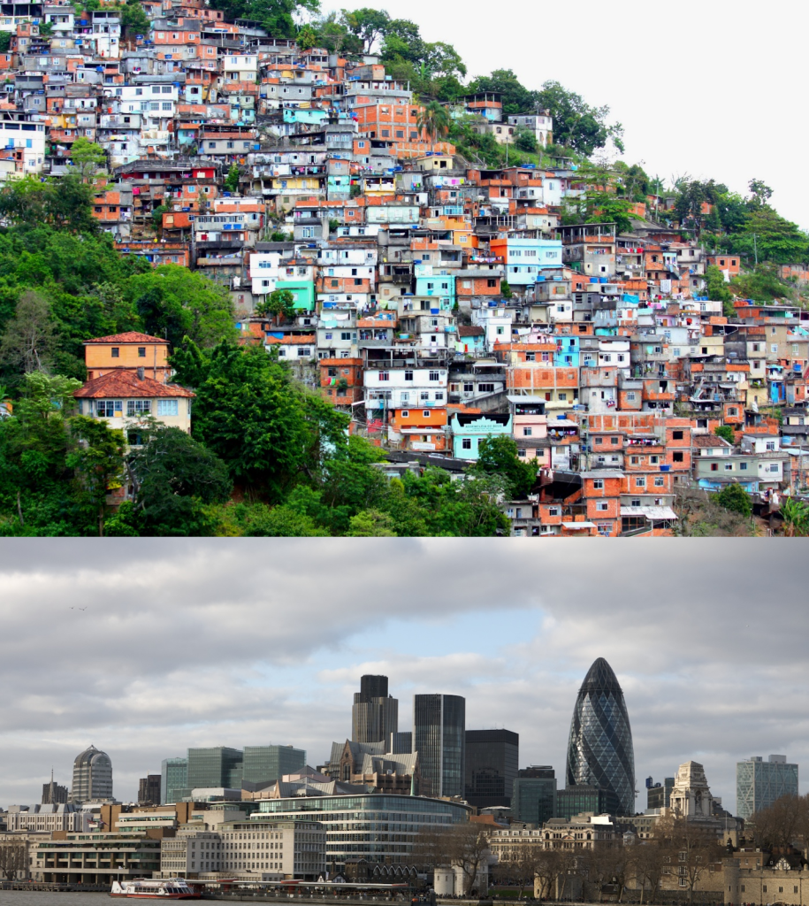
Slum cities refer to the development on the outskirts of cities of unplanned shantytowns or squats with no access to clean water, sanitation, or other municipal services. These slums exist largely outside the rule of law and have become centres for child labour, prostitution, criminal activities, and struggles between gangs and paramilitary forces for control. Mike Davis (2006) estimates that there are 200,000 slum cities worldwide including La Quarantaine (“Karantina”) in Beirut, the Favéla in Rio de Janeiro, the “City of the Dead” in Cairo, and Santa Cruz Meyehualco in Mexico City. He notes that while slum residents constitute only 6% of the urban population in developed countries, they constitute 78.2% of city dwellers in semi-peripheral countries. In Davis’s analysis, neoliberal restructuring and the Structural Adjustment Programs of the World Bank and the International Monetary Fund (IMF) are largely responsible for the creation of the informal economy and the withdrawal of the state from urban planning and the provision of services. As a result, slum cities have become the blueprint for urban development in the developing world.

On the other side of the phenomenon of global urbanization are global cities like London, New York, and Tokyo. Saskia Sassen (2001) describes the global city as a unique development based on the new role of cities in the circuits of global information and global capital circulation and accumulation. Global cities become centres for financial and corporate services, providing a technical and information infrastructure and a pool of specialized human resources (skills, professional and technical services, and consulting services, for example) to service the increasingly complex operations of global corporations. As such, they are progressively detached, economically and socially, from their local and national political-geographic contexts. They become instead nodes in a global network of informational, economic, and financial transactions or flows. It becomes possible in this sense to say that New York is closer to Tokyo and London in terms of the number of direct transactions between them than it is to Philadelphia or Baltimore.
Sassen (2005) emphasizes three important tendencies that develop from the formation of global cities: a concentration of wealth in the corporate sectors of these cities, a growing disconnection between the cities and their immediate geographic regions, and the development of a large, marginalized population that is excluded from the job market for these high-end activities.
The global city and the network of these cities is a space that is both place-centered in that it is embedded in particular and strategic locations; and it is transterritorial because it connects sites that are not geographically proximate yet are intensely connected to each other. If we consider that global cities concentrate both the leading sectors of global capital and a growing share of disadvantaged populations (immigrants, many of the disadvantaged women, people of color generally, and, in the megacities of developing countries, masses of shanty dwellers) then we can see that cities have become a strategic terrain for a whole series of conflicts and contradictions (Sassen, 2005).
Theoretical Perspectives on Urbanization
As the examples above illustrate, the issues of urbanization play significant roles in the study of sociology. Social diversity, economics, and human behaviour intersect in cities. Sociologists can look at urbanization through the perspectives of positivist, critical and interpretive sociology. Positivist perspectives on urbanization originated with the functionalist ecological mode of the city, critical perspectives have focused on Marxist political economy, whereas interpretive perspectives are indebted to Georg Simmel’s observations on the distinctive mental life of the metropolis.
Positivism, Functionalism, and Social Ecology
Human ecology is a functionalist field of study that focuses on the relationship between people and their built and natural physical environments (Park 1915). According to this Chicago School approach, urban land use and urban population distribution occurs in a predictable pattern once it is understand how people relate to their living environment and ecological niches. For example, in Canada, there is a transportation system geared to accommodate individuals and families in the form of interprovincial highways built for cars. In contrast, most parts of Europe emphasize public transportation such as high-speed rail and commuter lines, as well as walking and bicycling. The challenge for a human ecologist working in Canadian urban planning would be to design landscapes and waterscapes with natural beauty, while also figuring out how to provide for free-flowing transport of innumerable vehicles — not to mention parking!
Early Chicago School sociologists used an ecological model to map the zones in Chicago where high levels of social problems were concentrated. The social life of the city was seen as a social ecology in which human communities, like biotic communities, were bound together by complex relations of competition for resources and mutual dependence; a “process of competitive cooperation” as Park called it (1936). Like biotic communities, they argued that human communities could be analysed from an eco-system perspective as they went through periods of disruption, succession, and finally climax or maturity. As in natural ecosystems, the climax eco-system was when biotic balance and social equilibrium were achieved and maintained.
There are forces at work within the limits of the urban community–within the limits of any natural area of human habitation, in fact–which tend to bring about an orderly and typical grouping of its population and institutions. The science which seeks to isolate these factors and to describe the typical constellations of persons and institutions which the co-operation of these forces produce, is what we call human, as distinguished from plant and animal ecology (Park, 1915).
Chicago, during the 1920s and 1930s, was going through a period of disruption. It was experiencing the effects of rapid economic growth, urban expansion, and mass immigration. The Chicago School sociologists were therefore particularly interested in the zones of transition that emerged between established working class neighbourhoods and the manufacturing district. The city’s poorest residents tended to live in these transitional, economically deprived zones, where there was an uncustomary mixture of racialized groups, immigrant ethnic groups, and non-English speakers, and a high rate of flux as people moved in and out. They proposed that these zones were particularly prone to social disorder because the residents had not yet assimilated to the American way of life. When they did assimilate, they moved out and other newcomers moved in, making it difficult for a stable social ecology to become established there.
The concentric zone model (Burgess 1925) is perhaps the most famous example of human ecology. This model views a city as a series of concentric circular areas, expanding outward from the centre of the city, with various “zones” invading (new categories of people and businesses overrun the edges of nearby zones) and succeeding adjacent zones(after invasion, the new inhabitants repurpose the areas they have invaded and push out the previous inhabitants). In this model, Zone A, in the heart of the city, is the centre of the business and cultural district. Zone B, the concentric circle surrounding the city centre, is the location of the factory district and transport corridors (ports and reailyards). Zone C is the zone of transition composed of formerly wealthy homes split into cheap apartments for new immigrant populations; this zone also houses small manufacturers, pawnshops, and other marginal businesses. Zone D consists of the homes of the working class and established ethnic enclaves. Zone E consists of wealthy homes, white-collar workers, and shopping centres. Beyond Zone E are the estates of the upper class (exurbs) and the suburbs.
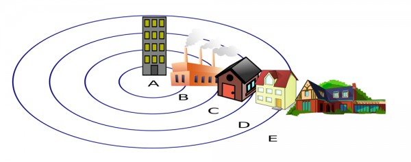
The analysis of social ecology emphasized urban development as a natural, “organic” process based on ecological principles of competition, adaptation and natural selection. Burgess (1925) described the tendency of cities to grow in concentric circles from the central business district outward as a quasi-natural process, just as Park (1915) regarded the segregation of people into different neighbourhoods based on class, ethnicity and race as similar to natural species occupying unique niches within an ecosystem.
Critical Sociology
In contrast to the functionalist approach, the critical perspective focuses on the dynamics of power and influence in the shaping of the city. One way to do this is to examine how urban areas change according to specific decisions made by political and economic leaders. Cities are not so much the product of a quasi-natural “ecological” unfolding of social differentiation and succession, but of a dynamic of capital investment and disinvestment. City space is acted on primarily as a commodity that is bought and sold for profit. The dynamics of city development are better understood therefore as products of what Logan and Molotch (1987) call the growth machine — coalitions of politicians, real estate investors, corporations, property owners, urban planners, architects, sports teams, and cultural institutions, for example — who work together to intensify land usage, attract private capital to the city and lobby government for subsidies and tax breaks for investors. These coalitions generally benefit business interests and the middle and upper classes while marginalizing the interests of working and lower classes.
For example, sociologists Feagin and Parker (1990) suggested three aspects to understanding how political and economic leaders control urban growth. First, economic and political leaders work alongside each other to effect change in urban growth and decline, determining where money flows and how land use is regulated. Second, exchange value and use value are balanced to favour the middle and upper classes so that, for example, public land in poor neighbourhoods may be rezoned for use as industrial land. Finally, urban development is dependent on both structure (institutions such as local government, real estate markets) and agency (individuals and groups, including businesspeople and activists), and these groups engage in a push-pull dynamic that determines where and how land is actually used. For example, NIMBY (not in my backyard) movements are more likely to emerge in middle- and upper-class neighbourhoods, so these groups have more control over the usage of local land.
Making Connections: Sociology in the Real World
What Happened to Affordable Housing?
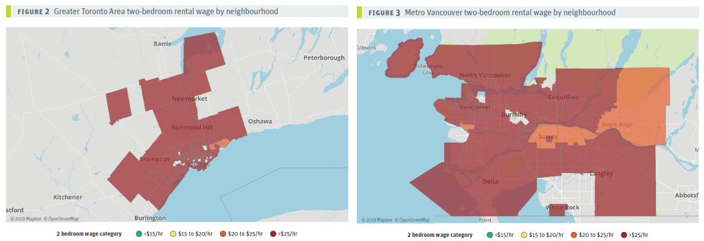
Having a permanent place to live is one of the basic requirements of people living in sedentary societies. Yet a major problem affecting city life in Canada since the 1990s has been the rapid increase in the price of housing and the unaffordability of home ownership and rentals. For renters it is generally recognized that the cost of accommodation should not exceed 30% of gross income (Lee, 2016), whereas for home ownership, a person who is employed full-time for an entire year should have the ability to put aside money for a down payment and pay off a mortgage within 25 years or less. These criteria seem unrealistic for many urban dwellers today.
From a political economy perspective, a key factor in the cost of housing in Canada has been the globalization of the real estate market and the treatment of housing primarily as investment property rather than as a place to live. The value of real estate has been progressively decoupled from local labour markets, making home ownership and even rental unattainable for people who live and work in cities. There is a growing disconnect between average incomes and housing prices. From 1984 to 2000, the cost of an average condominium (“condo”) or a single detached house compared to income remained relatively constant (Lee, 2016). Condos cost around 3.2 times the average income, while houses cost around 7.3 times the average income. By 2015, however, the ratio for condos doubled to more than six times income while the ratio for a detached house skyrocketed to more than 19 times income. In Vancouver, where the median after tax household income was around $79,500 in 2020 (Statistics Canada, 2022), the average single-family house sold for over two million dollars and ordinary condos went for eight hundred thousand dollars (Remax, 2020). High sale prices for homes have a subsequent effect in the rental market, keeping tenants in rental housing longer and reducing vacancy rates (Lee, 2016).
How can the value of housing decouple from the ability of residents to buy or rent it? One reason is the circulation of global wealth. Vancouver, for example, has become a global “gateway city” like London, New York, San Francisco, Hong Kong and Sydney, which attracts significant domestic and foreign investment in real estate speculation. In Vancouver’s case, investment has notably been from Mainland China, which has lead to ethnic tensions and resurgence of anti-Asian sentiment (Lee, 2016). But the issue is not so much where the investment capital comes from, as the fact that properties are being bought to flip for a profit or to hold appreciating value as investments. As a result, Vancouver has become the least affordable market in North America (Ley, 2021). These flows of investment capital were facilitated by a powerful growth coalition and lax regulations, as the neoliberal provincial government benefited significantly from the inflow of funds and shared common interests with the vigorous trans-Pacific property industry. The consequence of having a housing market driven by investor-owners like pension funds, hedge funds or corporations instead of local housing needs is the perverse creation of “zombie neighborhoods” where properties remain vacant.
Unsurprisingly, property ownership in a period of rapidly increasing housing prices has also significantly increased wealth inequality (Hemingway, 2018). In 2016, the wealthiest 20% of households held 62% of the net worth of principal residences in BC, and the next 20% another 25%, meaning that the lowest 60% held only 13% share of principal residence net worth. The wealthiest 20% households also owned 80% of secondary residences or cabins, and the next wealthiest 20% owned another 15% of these. As property values for single family dwellings in Vancouver grew by $47 billion in 2016 alone (about equal to the operating budget of the entire provincial government) and by $1 trillion province-wide between 2007 and 2016, the richest households who own the large majority of real estate wealth are the ones who have gained by far the most from the increase in property values.
Other causes for the rise in real estate values in Vancouver, Toronto and elsewhere in Canada include growth in population largely due to international immigration, low interest rates until the early 2020s allowing higher household debt, inter-generational transfers from parents who already own homes to their children, urban space constraints on building supply and government austerity measures that have reduced public investment in affordable housing (Lee, 2016; Rozworski, 2019).
Often the price of housing is presented as a simple problem of supply and demand. Build more housing stock and the prices will go down. However, Lee (2016) argues that it is necessary to think less in terms of a housing market and more in terms of a housing system in which governments play a central role. To address the problems of the housing crisis, he makes five recommendations:
- Build new affordable housing stock funded by the provincial and federal governments, with a focus on social and co-op housing.
- Preserve and re-invest in existing affordable housing.
- Create denser and inclusive housing in “complete communities”— low-carbon neighbourhoods where people live in closer proximity to where they work, shop, play and access public services.
- Create tax and other penalties for absentee ownership and speculative investment.
- Make property taxes fair: 1) make the property tax system fairer to renters; 2) reduce wealth inequality and improve the overall equity of the tax system; 3) curb speculation and external investment that drives up prices; and 4) raise revenues to help finance the housing agenda proposals listed above (Lee, 2016).
Interpretive Sociology
At the micro-level of interaction, sociologists have been interested in how human interaction is affected by living in cities. The modern city is characterized by a unique way of life that is qualitatively distinct from the rural and village life that dominated human societies for millennia. From an interpretive point of view, this way of life or urbanism has to be understood on
its own terms and not seen simply as a product of capitalism, industrialism, or modernity (Magnusson, 2011). In what ways is the modern city not simply a place where people live but a new social form with its own idiosyncratic social problems, styles of life, and modern “mental life”?
In his famous essay “The Metropolis and Mental Life,” Georg Simmel (1971 [1903]) described how the built environment and the sheer size and anonymity of the modern city had created a unique social form, which he called the metropolitan way of life. This was a form of social life or inner life which he distinguished point by point from rural life. It was produced by the effect of the external or physical characteristics of the metropolis (population, size, density, anonymity, and diversity, for example) on the psyche or subjective experience of the urban dweller. As Simmel put it, “the deepest problems of modern life flow from the attempt of the individual to maintain the independence and individuality of his [sic] existence against the sovereign powers of society, against the weight of the historical heritage and the external culture and technique of life” (Simmel, 1971 [1903]). As a means of self-protection against the city’s overpowering sensory input, people cut themselves off from potentially enriching contact with others and became cold, callous, indifferent, impatient, and blasé.
Simmel’s Metropolitan Way of Life
External Qualities of the Metropolis
- A large aggregate of people “who must integrate their relations and activities into a highly complex organism”
- Busyness, bustle and noise: a “swift and uninterrupted change of outer and inner stimuli”
- Anonymity
- Money as a medium of interpersonal relations
- Specialization and division of labour
Subjective or “Mental” Qualities of the Urban Mode of Life
- Sensory overload or “intensification of nervous stimulation”
- Intellectualism as a kind of protective/distancing device
- Unmerciful matter-of-factness in personal dealings vs. personal/emotional tone of behaviour
- Cold rational reckoning/calculating in interpersonal relations
- Blasé attitude (i.e., “seen it all before”)
- Outer reserve with respect to others and tendency to antipathy, repulsion, hostility and impatience towards them
- The experience of loneliness in a crowd
- Unprecedented personal freedom
- Unique individuation, or “the working out of a way of life”
- Specialization
- Self-differentiation and expressions of personal uniqueness such as “extravagances of mannerism, caprice and preciousness”
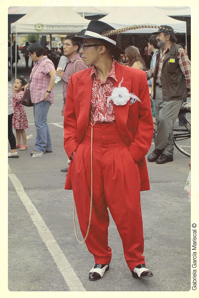
Although the metropolis, its architecture, and the variety of ways of life it contained were products of human creation and expression, as an entity it confronted the individual as an alien, concrete monstrosity that threatened to swallow city dwellers up in its “social-technological mechanism” (Simmel, 1971 [1903]). Individuals were “reduced to a negligible quality” and had difficulty “maintaining themselves under its impact.” But at the same time, the new anonymity and cosmopolitanism of the city offered the modern urban dweller an unprecedented amount of personal freedom and exposure to new ideas and ways of life. As opposed to the restrictions, pettiness and prejudices of the small community, the experience of cosmopolitan diversity enlarges “the individual’s horizon” so that the “inner life is extended in a wave-like motion over a broader national and international area” (Simmel, 1971 [1903]). In Simmel’s estimation the city was a social form (see Chapter 7. Groups and Organizations) that created freedom in a spiritualized and refined sense.
Media Attributions
- Figure 20.14 Downtown Vancouver sunset by MagnusL3D, via Flickr, is used under CC BY SA 3.0 licence.
- Figure 20.15 Population living in urban areas, Canada, 1871-2011 by Employment and Social Development Canada, 2014 is used under the Government of Canada Terms.
- Figure 20.16 Calgary Alberta circa 1885 by William Notman, at Library and Archives Canada, reference number C-017804, MIKAN ID number 3192503, via Wikimedia Commons, is in the public domain.
- Figure 20.17 Toronto sprawl by Payton Chung, via Flickr, is used under a CC BY 2.0 licence.
- Figure 20.18 Scorched car in Paris suburb, November 2005 by Alain Bachellier, via Flickr, is used under CC BY-SA 2.0 licence.
- Figure 20.19 (top) Brasil/Rio Do Janeiro/Favéla Morro Do Prazères by Dany13, via Flickr, is used under a CC BY 2.0 licence; (bottom) Financial Distric by Peter Pearson, via Flickr, is used under CC BY SA 2.0 licence.
- Figure 20.20 Saskia Sassen by Ot, via Wikimedia Commons, is used under a CC BY-SA 4.0 licence.
- Figure 20.21 Concentric ring model of urban land use by Zeimusu, via Wikimedia Commons, is in the public domain.
- Figure 20.22 “Figure 2 Greater Toronto Area two-bedroom rental wage by neighbourhood” and “Figure 3 Metro Vancouver two-bedroom rental wage by neighbourhood”, from Unaccommodating (Macdonald, 2019, pp. 16–17), is used under a CC BY-NC-ND 3.0 licence. The images have been modified by putting them together side by side in a single image.
- Figure 20.23 Pachuco rockalavera 2012 by Maria Mariscal, via Wikimedia Commons, is used under a CC BY 2.0 licence.

